Geocoding in the UK: How It Works and Why It Matters
In today’s digital world, location data plays a key role in how businesses and services operate. From finding directions on a map to delivering parcels to the correct address, accurate location information is essential. One of the technologies that makes this possible is geocoding.
Geocoding is widely used across the UK in mapping, logistics, retail, and public services. It helps convert addresses into precise geographic coordinates, making it easier to analyse and use location data. In this article, we’ll explore how geocoding works, its role in mapping, and why it matters for businesses.
What Is Geocoding?
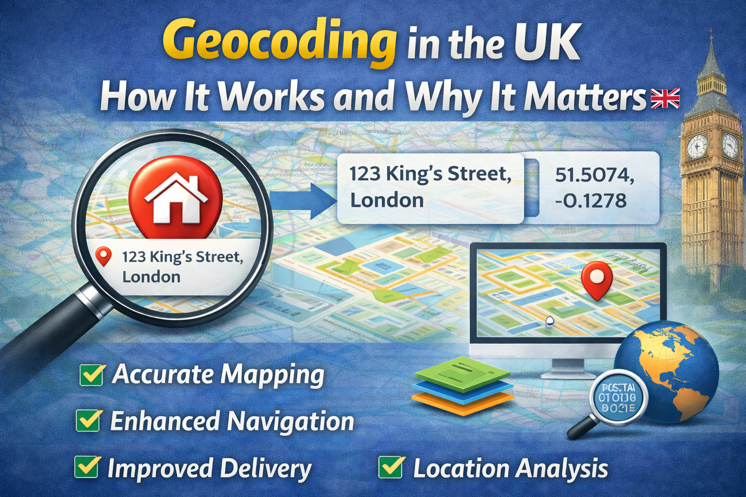
Geocoding is the process of converting a physical address into geographic coordinates, such as latitude and longitude. These coordinates can then be used to pinpoint the exact location on a map.
For example, when you enter an address into a navigation app, geocoding is used to find its exact position. The system takes the written address and translates it into a set of coordinates that can be displayed visually.
In the UK, geocoding often relies on trusted datasets like Ordnance Survey and Royal Mail address data. These datasets ensure that the results are accurate and up to date.
Geocoding is not just about maps—it also forms the foundation for many location-based services that businesses and organisations depend on every day.
How Geocoding Works in the UK
Geocoding works through a series of steps that transform address data into usable geographic information. First, the system takes an input address, such as a postcode or full street address.
Next, the address is analysed and broken down into components like house number, street name, town, and postcode. This process is known as parsing.
The system then compares the address with official databases to find a match. Once a match is found, the corresponding geographic coordinates are assigned to that address.
In the UK, geocoding systems often integrate with authoritative data sources, ensuring high levels of accuracy. Some systems also use advanced algorithms to handle variations in address formats or minor errors.
The result is a precise location that can be used for mapping, navigation, and analysis.
The Role of Geocoding in Mapping and Navigation
Geocoding is at the heart of modern mapping and navigation systems. Without it, digital maps would not be able to display accurate locations or provide directions.
When a user searches for a location, geocoding converts the address into coordinates, allowing it to appear on the map. This enables users to find places, plan routes, and explore areas بسهولة and quickly.
In the UK, mapping services rely on geocoding to provide accurate and detailed information. This is especially important in cities with complex street layouts or rural areas where addresses may be less standardised.
Geocoding also supports route optimisation. By using geographic coordinates, systems can calculate the fastest or most efficient route between locations. This is widely used in navigation apps and delivery services.
Overall, geocoding makes mapping systems more reliable and user-friendly.
Business Benefits of Geocoding
Geocoding offers a wide range of benefits for businesses across the UK. One of the main advantages is improved operational efficiency. By converting addresses into precise coordinates, businesses can streamline processes such as deliveries and service planning.
For logistics companies, geocoding helps drivers locate addresses more easily, reducing delays and fuel costs. It also supports route optimisation, allowing companies to deliver more orders in less time.
Retail businesses can use geocoding to analyse customer locations and identify trends. This helps in planning store locations, targeting marketing campaigns, and understanding customer behaviour.
Geocoding also improves data quality. By linking addresses to coordinates, businesses can ensure consistency and accuracy across their systems. This supports better decision-making and reduces errors.
In addition, geocoding can be integrated with other technologies, such as Geographic Information Systems (GIS), to provide deeper insights into location data.
Supporting Location Intelligence and Data Analysis
Geocoding plays a key role in location intelligence, which involves analysing geographic data to gain insights. By turning addresses into coordinates, businesses can visualise data on maps and identify patterns.
For example, a company can map customer addresses to see where demand is highest. This information can be used to plan marketing strategies, optimise delivery networks, or expand into new areas.
In the UK, geocoding is often used alongside GIS tools to combine multiple datasets. This allows organisations to analyse factors such as population density, traffic patterns, and service coverage.
Location intelligence is especially valuable in sectors like healthcare, utilities, and public services. It helps organisations make informed decisions and improve service delivery.
By enabling advanced analysis, geocoding turns simple address data into powerful insights.
Challenges and the Importance of Accuracy
While geocoding is a powerful tool, it is not without challenges. One of the main issues is data quality. If the input address is incorrect or incomplete, the resulting coordinates may also be inaccurate.
In the UK, address formats can vary, which can make geocoding more complex. For example, properties with names instead of numbers or multi-unit buildings can be harder to process.
To overcome these challenges, it is important to use reliable data sources and address validation tools. These tools ensure that addresses are correct before they are geocoded.
High accuracy is essential, especially in industries like logistics and emergency services, where even small errors can have serious consequences.
By maintaining accurate data and using advanced systems, businesses can maximise the benefits of geocoding.
The Future of Geocoding in the UK
As technology continues to evolve, the role of geocoding in the UK will become even more important. With the rise of smart cities, connected devices, and real-time data, accurate location information is essential.
Future geocoding systems are likely to become more advanced, using artificial intelligence and machine learning to improve accuracy and handle complex data. They will also integrate more closely with other technologies, such as GIS and address matching systems.
In addition, the availability of open geospatial data in the UK will make geocoding more accessible to businesses of all sizes. This will encourage wider adoption and innovation.
As demand for location-based services grows, geocoding will remain a key technology for businesses and organisations.
Read also: Advanced scanning tech: revolutionizing security and healthcare
Conclusion
Geocoding is a fundamental technology that powers mapping, navigation, and location-based services in the UK. By converting addresses into geographic coordinates, it enables accurate and efficient use of location data.
From improving delivery operations to supporting data analysis and business planning, the benefits of geocoding are clear. It helps organisations work smarter, reduce errors, and make better decisions.
As the digital landscape continues to grow, the importance of geocoding will only increase. For businesses looking to stay competitive, understanding and using geocoding is essential for success in a data-driven world.