The Science Behind Using Ground Penetrating Radar for Utility Mapping
Accidental strikes on buried pipes and cables cost Australian projects millions each year in repairs, delays, and safety incidents. With utility networks growing denser beneath city streets, accurate subsurface detection has become essential for anyone planning to excavate. Ground penetrating radar, commonly known as GPR, is now one of the most trusted tools for this job. This piece explains the science behind it, what makes it effective, and where its limits lie.
How Ground Penetrating Radar Actually Works
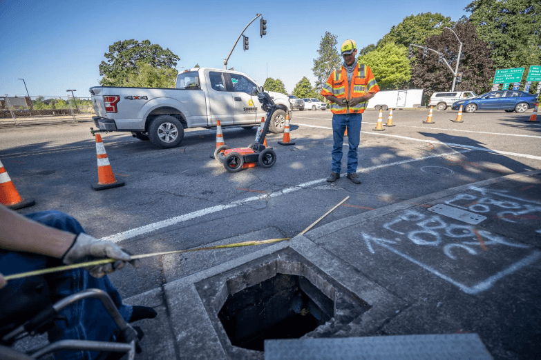
Ground penetrating radar (GPR) sends short bursts of electromagnetic energy into the ground through a transmitter antenna pressed against the surface. When this energy hits a pipe, cable, or something else (even a change in soil type) that’s buried, part of it bounces back.
A receiver antenna picks up the reflected signal and records two things:
- How long did the reflection take to return
- How strong it was
Several factors shape what GPR can and cannot pick up:
- Antenna frequency has a big role here. A high-frequency antenna around 1,600 MHz gives sharp, detailed images but only reaches shallow depths. A lower frequency around 250 MHz penetrates deeper, though the image loses some clarity.
- Soil type matters just as much. Dry, sandy ground lets radar signals travel well. Wet clay absorbs the energy fast and cuts the effective range.
- Material contrast drives detection. GPR relies on differences in a property called dielectric permittivity. A metal conduit sitting in a sandy fill creates a strong contrast and shows up clearly. A PVC pipe buried in uniform clay is much harder to spot.
How Results Look
Operators view the results as a radargram, which is essentially a cross-sectional image of the ground. Curved shapes called hyperbolas in that image often point to buried objects. But the data does not come with labels attached.
Telling a gas main apart from a tree root takes real skill and experience. That is why firms offering ground penetrating radar services usually combine GPR with electromagnetic locating for a fuller, more dependable picture of what sits below.
Why GPR Suits Utility Mapping So Well
Older detection methods have well-known blind spots. Paper-based as-built drawings go out of date quickly, and electromagnetic cable locators only respond to conductive materials such as metal pipes or energised cables. GPR closes that gap because it picks up both metallic and non-metallic targets.
In practical terms, that matters for a few clear reasons:
- Non-metallic infrastructure is everywhere now. Stormwater drains, sewer lines, and gas mains increasingly use PVC, HDPE, or concrete. GPR is one of the very few non-destructive options that can find them.
- There is no physical contact with the buried asset. Scanning happens at the surface, so the risk of nicking or rupturing a shallow service drops significantly.
- Data collection is fast. A trained operator can cover hundreds of linear metres in an hour, which keeps large site surveys on schedule.
According to Australia’s Dial Before You Dig program, the country records over 50,000 asset strikes annually. A large share of those involve utilities that were either missing from plans or plotted in the wrong spot. Running a GPR survey before breaking ground helps catch these gaps early, well before a backhoe does.
See also: Host Seamless Business Events with Adaptable Outdoor Structures
Limitations and Best Practices for Reliable Results
No single tool works perfectly in every scenario all the time, and GPR is the same. Knowing where it struggles allows teams to plan smarter surveys. It also helps avoid putting too much faith in a single data source.
The most common challenges look like this:
- Wet, clay-rich soils conduct electricity well, which means they soak up radar energy before it reaches deeper targets. Penetration depth can drop sharply.
- Crowded utility corridors create overlapping reflections on the radargram. Separating one pipe from the next becomes tricky when everything sits within centimetres of each other.
- Depth estimates can shift across a single site. Accurate depth readings depend on the radar wave velocity through the soil, and that velocity changes with moisture content and soil composition.
Good operators manage these issues through calibration. They test against a utility with a known depth on site to ground-truth their readings. Running multiple antenna frequencies during a single pass also helps. A high-frequency sweep catches fine, shallow detail, while a lower frequency fills in the deeper picture.
It is worth noting that Australian Standard AS 5488 sets out quality levels for subsurface utility information, from Quality Level D (desktop records only) up to Quality Level A (physical potholing). GPR typically delivers Quality Level B data, which sits well above plans-only information and gives engineers a much stronger basis for design decisions.
Conclusion
GPR brings a solid scientific foundation to a problem that used to rely heavily on guesswork and outdated records. It works by reading contrasts in subsurface materials and turning radar reflections into images that skilled operators can interpret. Soil conditions, site congestion, and calibration all affect the quality of results. Even so, GPR remains one of the most versatile non-destructive survey methods available in Australia, and pairing it with good field practice gives project teams the confidence to dig safely.